
Kunta3D is a Finnish web-based platform for publishing, visualizing, and collaborating with 3D city models. Designed specifically for municipalities and cities, it enables users to publish, view, and share planning, construction, and infrastructure data within a single 3D environment. Kunta3D also supports public participation by enabling municipalities to engage businesses and residents in urban development.
Open standards
IFC
An open standard for exchanging building and infrastructure information. Widely used in Building Information Modeling (BIM) projects to enable seamless data exchange between software applications and project stakeholders.
CityGML
An international open standard for storing and exchanging 3D city models. It provides a consistent way to represent buildings, terrain, infrastructure, and other urban features across different systems and applications.
LandXML / Inframodel
An open file format used in geospatial and infrastructure design for storing and exchanging data related to land development, roads, railways, surveying, and civil engineering. Supported by a wide range of CAD, GIS, and BIM software.
3D Tiles
An open OGC standard designed for efficient streaming and visualization of large-scale 3D geospatial datasets on the web. It enables dynamic loading of massive city models, point clouds, and terrain data without requiring the entire dataset to be downloaded at once.
Integrations
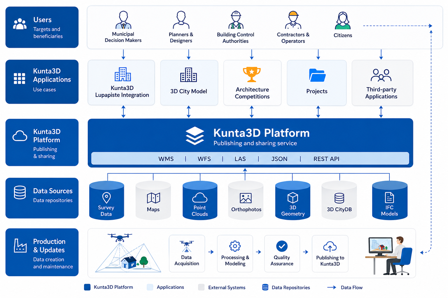
REST API
Open REST APIs enable seamless integration of Kunta3D with other systems and support automatic data exchange without manual work.
WMS
Publish and access map layers through the standard WMS interface for use in GIS and other applications.
WFS
Access, manage, and synchronize geospatial features through the WFS interface, ensuring up-to-date data across different systems.
Lupapiste
Connect the building permit process with your 3D city model. View and manage Lupapiste data directly within Kunta3D.
Kunta3D architecture